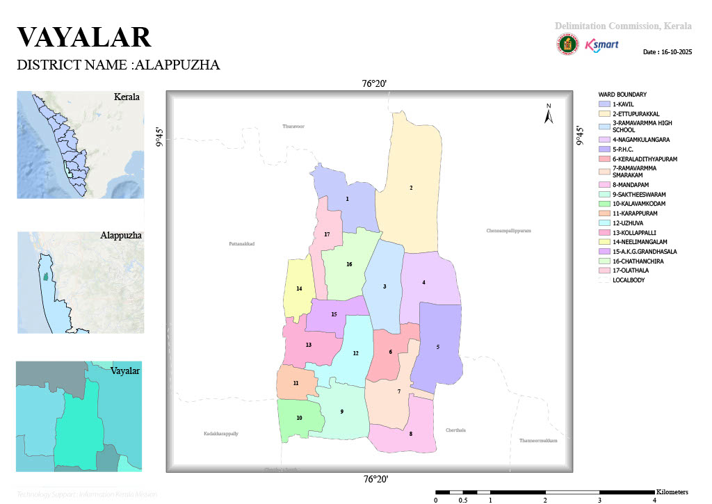
Map 2026
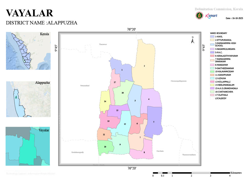
Vayalar Grama Panchayat – Electoral Ward Delimitation Order
As per the order issued by the Kerala Delimitation Commission on 15 May 2025, the number of elected representatives in Vayalar Grama Panchayat has been fixed at 17, and the Panchayat has been divided into 17 electoral wards.
| Ward No. | Ward Name | Population |
|---|---|---|
| 01 | Kavil | 1,583 |
| 02 | Ettupurakkal | 1,437 |
| 03 | Ramavarma High School | 1,470 |
| 04 | Nagamkulangara | 1,578 |
| 05 | PHC | 1,597 |
| 06 | Keraladityapuram | 1,470 |
| 07 | Ramavarma Smarakam | 1,578 |
| 08 | Mandapam | 1,597 |
| 09 | Saktheeswaram | 1,326 |
| 10 | Kalavamkodam | 1,334 |
| 11 | Karappuram | 1,348 |
| 12 | Uzhuva | 1,315 |
| 13 | Kollappally | 1,348 |
| 14 | Neelimangalam | 1,380 |
| 15 | A.K.G. Granthasala | 1,410 |
| 16 | Chathanchira | 1,602 |
| 17 | Olathala | 1,429 |
Key Points
- Vayalar Grama Panchayat has been reorganized into 17 wards.
- Separate boundaries have been defined for each ward.
- The wards have been delineated to maintain a population of approximately 1,300 to 1,600 residents per ward.
- Ward with the highest population: Chathanchira (1,602 residents).
- Ward with the lowest population: Uzhuva (1,315 residents).
- This delimitation will serve as the ward structure for the next Local Self-Government Elections.
The reorganization aims to ensure balanced population distribution and equitable representation across all wards within the Panchayat.